


South End
BIG IDEA: Construct a freeway cap between Streets linking Uptown and South End
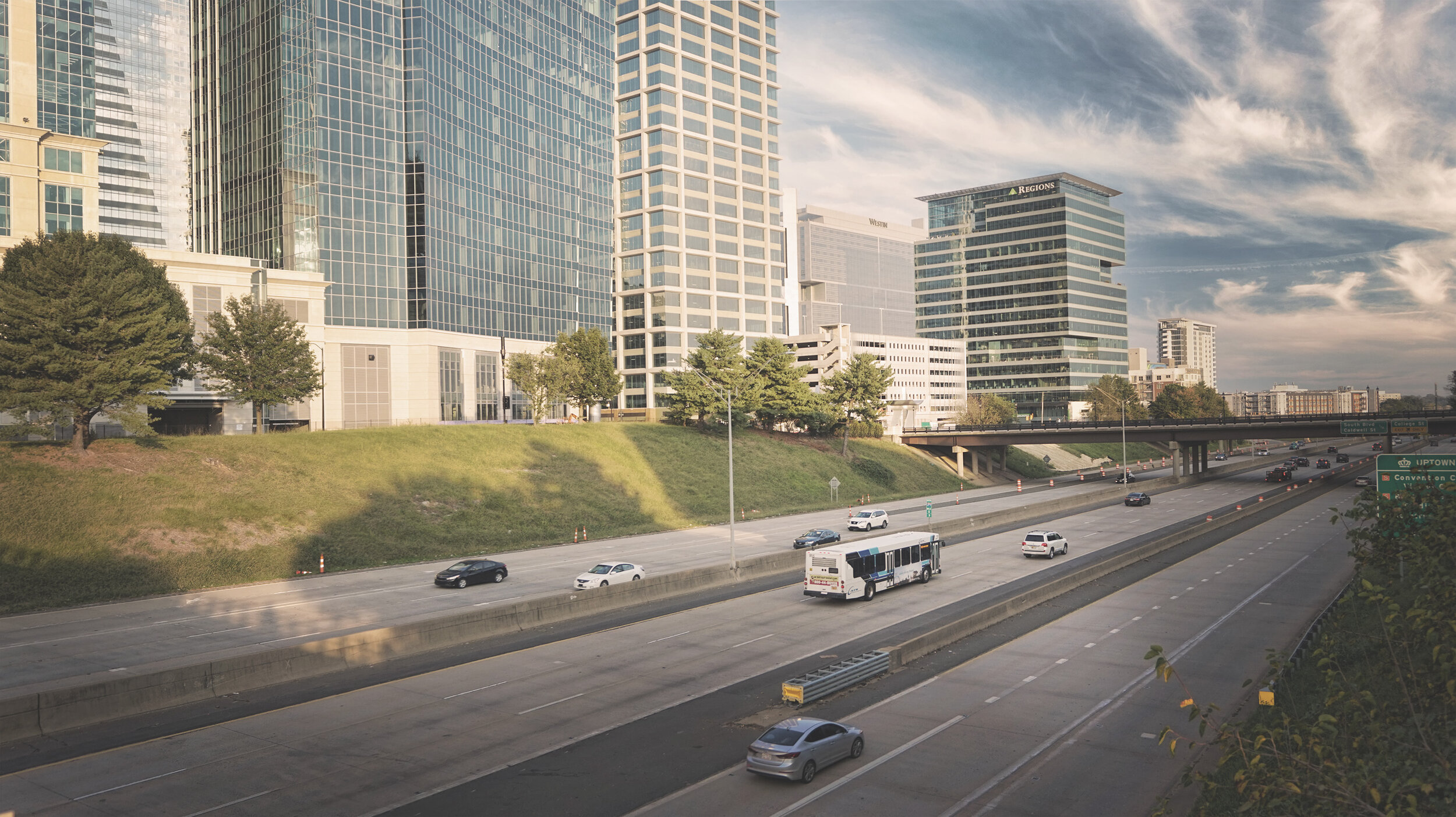
South End - Existing Condition

South End - Proposed Conditions

Context and Rationale
The South End has transformed over the last decade into a vibrant, residential mixed-use neighborhood and extension of Charlotte’s core business district. This tremendous growth has strained the city’s infrastructure and systems, and South End is still disconnected from Uptown, with limited options for pedestrian and bicycle connections. However, new development, energy, and infrastructure between the Bank of America Stadium and Tryon Street are transforming the area (see Figure 6.D.1).
Directly connecting Uptown to the South End can be achieved with a “big move” of adding a freeway cap over I-277, where it runs below grade. Building over the freeway would effectively create new, taxable city blocks, while allowing traffic to move underneath them. This new land could be used for a grand new public space, lined with mixed-use buildings fronting the park providing myriad opportunities for community gathering and events, public art, and economic development
Objectives
• Continue to implement recommendations in the South End Vision Plan
• Seamlessly connect South End and Uptown
• Update and continue to implement the strategies and recommendations in the Blue Line Rail Trail Vision and Framework Plans
• Leverage investment to create a new park and more public space with public art, community-oriented retail and amenities as well as arts, cultural and civic venues
• Ensure roads, sidewalks and utilities in the South End support density and continued growth

Strategies and Recommendations
D1. CREATE NEW CONNECTIONS BETWEEN UPTOWN AND SOUTH END TO OVERCOME THE FREEWAY BARRIER
D1-1 Construct the new Rail Trail Pedestrian Bridge to complete the trail gap and provide a safe dedicated pathway for pedestrians and cyclists across I-277
D1-2 Create a freeway cap over I-277 between South Church and South College Streets to create developable land, a new public space, and a seamless connection between Uptown and South End
D1-3 Identify options for development along the park edges and include small-scale commercial spaces and other business opportunities for entrepreneurs of all cultures, and public art
D1-4 Construct the planned Stonewall to Euclid bridge across I-227
D2. ENHANCE THE BLUE LINE RAIL TRAIL TO CONTINUE ITS TRANSFORMATION INTO A COHESIVE, WELL-DESIGNED DESTINATION AND AMENITY FOR RESIDENTS AND VISITORS
D2-1 Continue to implement the recommendations in the Blue Line Rail Trail Vision and Framework Plans as well as the Rail Trail Public Art Master Plan
D2-2 Produce an updated Rail Trail enhancement and investment strategy that includes
› Economic impact analysis and strategy
› Pedestrian counts and other user data
› Community engagement
› Public realm programming and management strategies
› Conceptual and schematic designs, construction documents and cost estimates
› Structure for facility management, funding, governance and maintenance (e.g.,501c3 Friends of the Rail Trail)
D2-3 Develop and implement signage and wayfinding system for the Rail Trail
D2-4 Work with CATS and other City departments to create cohesive but distinct brands for all current and future Rail Trails
D2-5 Establish a public and private sector partnership to fund, manage and advise the process
D3. CREATE A COMPREHENSIVE COMMUNITY INFRASTRUCTURE PLAN FOR THE SOUTH END TO ENSURE EFFICIENT AND SUSTAINABLE GROWTH
D3-1 Create a capital improvement plan for South End stormwater and sewer systems to ensure adequate infrastructure supports new and existing development
D3-2 Maximize green infrastructure and low-impact development opportunities
D3-3 Implement the South End Vision Plan street design guidelines and the TOD / Blue Line Streets Map to ensure streets and sidewalks are designed for dense residential and commercial neighborhoods


